Archive for the ‘OpenStreetMap’ Category

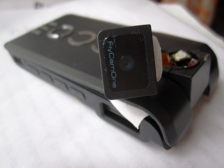
FCOIII looking sad

January 7, 2011

This is my FPV camera after a 200m dive from the kite when the rig failed yesterday.
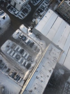
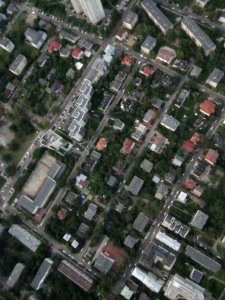
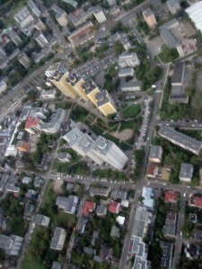
It fell on the roof of a Ferrari car-service (seen below from a photo camera which made it safely to the ground) and it kept recording/transmitting for another 30 minutes despite the twisted head joint and being covered in snow.

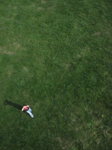
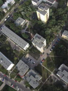
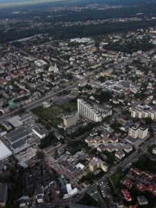
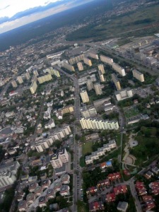
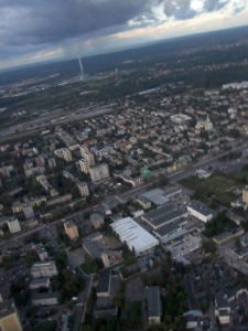
By the way I have selected some of the occasional interesting aerial shots taken by the camera as it’s making the vertical imagery or from a paraglider or airplane window or on other occasions, and collected in a picasa album here, though I now have a two months backlog of winter kite pics.

In other news last week groupon.com had an offer for sight-seeing flights over Warsaw in a two-seater ultra-light airplane for just about EUR20. I bought three coupons :)  They let you decide the route and altitude and buy additional kilometres for 50cent/km and I hope that will let me complete most of the free (as in freedom) orthoimagery map for my city, till now made with the kite or rc helicopter.

MediaLab Chrzelice and KAP

September 6, 2010

Three weeks ago I took part in the MediaLab Chrzelice aka. Culture 2.0 Camp, and didn’t have time to mention it here yet.  I wrote about it in some more detail at the OSM diaries here & here, but let me just say that it was lots of fun, and I’m also really satisfied with how the OpenStreetMapping part of the workshop turned out.  I was never really good at convincing people to do things, but at the workshop I had introduced the project to people who had never heard of OSM and they were immediately very eager to actually go out and start collecting data and then putting it onto the map as quickly as possible (specially since the village where this was held was a very blank spot), which was very satisfying to see.  The GPSes hadn’t arrived, and we didn’t manage to produce good aerial imagery, but trying to launch the balloon and then flying the kite was fun anyway (possibly educative? when something fails is it more educative or less educative?). Two people who had come from Warsaw like me signed up for re-trying the balloon launch some time in the coming weeks, using some new ideas we had. Also one of the concurrent workshops was the Arduido workshop led by Daniel Soltis of Tinker.it! London and I got an arduino kit as a gift. I had some ideas of things I’d like to do with an arduino board, the only problem is I’m truly clueless about low-level electronics (I’m definitely a software person), I can’t even solder properly, so whatever I do with it, I’ll need help making any use of it.

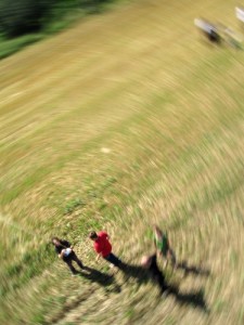
My friend and me had some more attempts at Kite Aerial Photography here in Warsaw after I was back and actually are starting to get some nice pictures although I still need to build a better rig for the camera and get more line (currently have 600 metres and that let us lift the camera to 450-500 metres above the ground).  The current rig was the “plastic bottle”-type (aka. pendulum type) just without the bottle, using just string and duct tape, and attached just about 3m below the kite.  The advantage is that you get pictures taken in all directions.  With a picavet-type rig they will be looking straight down but the swinging is greatly reduced, specially if the rig is attached some 20 metres below, and so you can get much better ground resolution even on not-as-sunny days, because the exposition times can be longer and ISO lower.  So possibly I’ll be attaching multiple cameras instead of one to cover more directions, or building/ordering one of the fancy RC rigs (but more likely just attaching three or four cameras if I can get them from somewhere).  I figured out how to do “interval photography” with a WebOS phone like the Palm Pre (without installing any App Store apps like the Time Lapse Maker for EUR1.99) and I’ll post my app here later — turns out making webOS apps is really simple, even if you’ve never made any you can make a time-lapse app in about 1h without using any SDK or documentation, when on a bus trip for example.

Also my early impression with the latest Canon cameras is that they are terribly bad and there can seriously be no other reason to buy one other than CHDK suport (although the really new ones are not supported anymore because the firmware blobs encryption has changed — particularly what the CHDK developers call the dancing bits sequence).  If you’re looking for a nice pocket camera with high ccd resolution, get a Casio for example (seems to be just starting in the pocket camera market), although not usable for KAP.  I was never very up-to-date with things like hardware specs and prices and benchmarks but now that I had to decide on a camera, I’m taking the opportunity to sound like I have a clue :)

For the next couple of weeks I will be super busy with a university project (I even took a week of vacations at work) and will resume my world dominationkite flying plans afterwards.  I’m also seriously considering RC drones, some of the cheaper ready-to-fly models are slightly cheaper than the bigger kites.  The problem with the kites is that to make a good photo-map suitable for mapping, covering the area size of Warsaw, I’d need to fly it in about 80 places in the city and while it’s fun, it’s also tiring, possibly risky (if you haven’t registered with air traffic control a week ahead) and very weather-dependent.  With drones these are all things yet to figure out as people are just starting to experiment as far as I see on the web.

BAP test flight 1

August 8, 2010

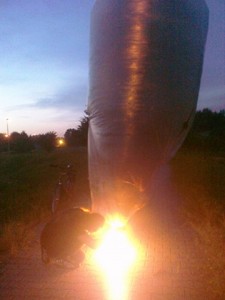
Our first attempt at Balloon Aerial Photography (or BAP) statistics:

one Canon CHDKed camera dead after landing in the water, a good amount of CO2 released into atmosphere. (The camera may still live when it dries.. the SD card works)

To be continued.

Mostly done with Szczecin

June 20, 2010

In the last two months I spent quite a lot of time working on a data import into OpenStreetMap that has been a little different from most of the imports happening in the project.  I’m quite happy with the result but I’m also really happy to be done with in.

Most of Poland administrative institutions today are behind in the aspect of sharing information with others for common good, and information re-use (and in many other aspects).  This includes geospatial data and clinging on to it and always assuming there might be something secret in it, such as… I don’t know, really.  Obviously at some level there can be information protected by the privacy laws intermixed with geospatial data (parcel owners etc.), the other common case of spatial data that cannot be shared is the locations of protected species.  But most of the time none of this is concerned.

Then there are laws in place that mandate those institutions to take money for disclosing particular types of information, and only under rather restrictive licensing conditions (nothing that remotely resembles CC-By-SA).  But according to some people in the know, there are other laws in Poland that make most of this information classify as public information.  Theoretically those former laws take precedence over the public information related ones, but last I heard there’s some other legal complication, way above my level of understanding law (unfortunately), that in effect means there’s a conflict/inconsistency in that system.  What this means is that the institutions can assume either interpretation and they should be safe under the law.  But they will always assume the “closed” interpretation.

So looking at all the other places and “battles” that people in OpenStreetMap have with their local administrations, it seems that this is a common trace in Europe, with a slowly progressing change in the direction of openness.  But perhaps if you drew a little map of how “open” the institutions in different places are based on the number of data releases that happened, the area covered by Poland would mostly range between black and dark grey.  So it was a lucky strike that the city of Szczecin was happy to let us use all the information available through their GIS website, including for automatic processing.

Their website has bitmap layers with some pretty high quality data, and no vector data available directly.  This meant that it could be manually copied or some complex and rather hacky vectorisation could be attempted (obviously talking only about the data layers that were lacking in OpenStreetMap, not just everything — if you’ve done any OSMing, you know that some types of data are unlikely to be crowdsourced).  French mappers are trying to manually copy the national cadastre bitmap layer made available by their administration, but it seems like a very tedious work, which is unlikely to be finished soon.  So I tried to automate as much as possible of the vectorisation and I think in a big part it was a success.  Still quite a lot of manual work was left to be done.  Not a very interesting job, but not one that you can let some monkeys do for you either, because everything that could be automated has already been automated.  So I’m really happy that it’s mostly done now (import status page firefox only, and takes a while to load).  More details in Polish available in this post, but check out the mapsurfer screenshots and the tree density heat-map there.  Maybe I’ll have a lightning talk about it at the upcoming State Of the Map 2010.

We’ve contacted some other municipalities trying hard not to scare them with the modern terms like share-alike etc., and as expected they are reluctant, but there seem to be two more candidates right now, and the import process is better streamlined now, and it really could be quite straight forward if it was not for some little annoying properties of the way the Szczecin data was shared.

For the moment I have a long backlog of information surveyed in my own neighbourhood to put on the map.
New stuff

March 7, 2010

Over christmas (it’s March, the perfect time to post your new year’s post! Happy new year, BTW!) I finally sat down and re-made www.openstreetmap.pl, the site about OpenStreetMap in Polish, similar to what you can find at the other openstreetmap sites under country-level domains.  It’s nothing spectacular but the remake was long overdue.  While at it I also launched a blog where any high-level news or propaganda about freeing geospatial information and about OpenStreetMap itself, relevant to Poland (or not), can be posted in Polish.  I think there was a need for a place like this even though there isn’t a whole lot to post there yet and not a whole lot of interest either (yet).  The openstreetmap diaries at the main site collect all kind of small and big news and user comments, so I missed a place that’s like the OpenGeoData blog in English.  If you have anything relevant to share, you can post it on blog.openstreetmap.pl now.

Second new (to me) thing in the last months was the internet’s reaction to the disaster that was the Haiti earthquake January 12.  It caused a great range of destruction and chaos and when the humanitarian relief teams rushed there it became apparent that lots of IT resources available for other places were not available for that area.  This is where people all over internet tried to help and their reaction was somethign I had never seen before, a whole new experience.  The leading by CrisisCommons and the crisis camps organised as soon as January 15 where people met to code new needed services, give ideas or just collect data.  On one day we saw more than 20 people from different crisis camps around the world joining the OpenStreetMap IRC channel asking if there was anything urgent for them to work on right now, and everyone planning how to best use their time resources.  Needless to say the advancement in terms of data quality the Port-au-Prince area was huge, much bigger than in the case of the Gaza strip initiative a year ago and than perhaps any other moment in OSM history.  Other very cool projects like this also sprung up really quickly.  A very interesting experience alltogether, one that also exposed the OSM project in a new use case / situation.  OSM proved extra valuable in it and this is always a gain for the project at the same time, now that it became part of the official FEMA resources, International Red Cross’s as well as US navy’s and got some more mainstream media attention than usually.  Now the newly created HOT or Humanitarian OpenStreetMap Team is gearing up for helping Chile overcome the damages resulting from the recent quake and is already providing accurate maps of the flooded Albanian regions.

Wikipedia overlay

October 6, 2009

Last week I’ve set up an overlay for OSM that displays Wikipedia links completely obstructing the view of the map.  I explained it in more detail in this mailing list posting, but other people have blogged about it so I probably should too.

It’s not like the Google wikipedia layer because it display links from OpenStreetMap entities to Wikipedia, not the other way.  At the low zoom levels you’ll only see dots but if you zoom in to an interesting place there will be roads, rivers, polygon areas etc all linking to respective Wikipedia pages.  Only Firefox is supported because I’m not using OpenLayers (but some WebKit-based browsers seem to work some of the times, and a commercial browser starting with O).

The goal of this is to get more people using the wikipedia= tag in OSM — if you’ve been making applications with OpenStreetMap data you’ve surely noticed that people much more often map features that get visualised somewhere in some way.  It’s also an experiment in a couple of directions: it’s a tiled GeoJSON layer (as opposed to bitmap tiles) — this gets us browser caching and seems to be much faster than an area query like OpenStreetBrowser uses.  The tiles can be retrieved using JSON-P in addition to xhr, I also have added a kind of “kinetic” zoom — the base map widget is based on Bernhard Zwischenbrugger’s excellent zoom zoom zoom map in place of OpenLayers, meaning it’s also 20 times smaller in terms of lines of code.  Also zoom beyond mapnik tile levels is supported, this may be good accessibility wise even though it’s a bad workaround for the default mapnik style rendering names in a pretty small font.

I’ve also set up a http redirect for wikipedia interwiki links and images that saves you one click, it’s fully described at the OSM forums but in short, if you only know the german title of a wikipedia page referring to something, you can type http://wp.openstreetmap.pl/de:Bananen and you’ll be redirected to a page about bananas in the language configured in your browser.  http://es.wp.openstreetmap.pl/de:Bananen in turn will send you to the Spanish page about bananas, i.e. http://es.wikipedia.org/wiki/Musa_×_paradisiaca