Archive for the ‘KAP’ Category

Temperature graphs from EXIF header

January 15, 2011

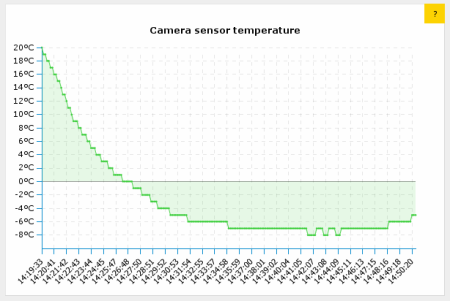
In case it’s interesting to anyone I generated simple graphs showing temperature change when sending a camera up in the air using the tags in the images.

These two are from a camera attached to my kite on different winter days.  You can see how the temperature decreases about 1C every 100m of altitude and the camera then gets warmer again while lowering the kite back to the ground (up to about -4C), nothing surprising in there.

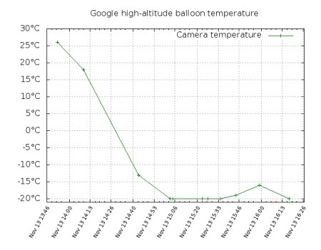
(I was curious what the minimum was the camera would operate in since Li-ion and Li-poly batteries are known to perform poorly in sub-zero temperatures, most of the time giving less than 3V.  My Canon was showing “change batteries” all the time but then showed 65% again when warmed at home.)  Well, here’s a gnuplot graph from a near-space balloon flight, unfortunately with much fewer data points, where you can see that a Canon G11 still works in under -20C.

I extracted these temperatures from the headers of the images taken by the seven Google Android branded high-altitude balloons at Greg Klein’s hibal.org page, launched in November reaching over 100000ft. There are only 15 pictures on that page and they possibly come from different balloons as the seven balloons were launched over a period of 2 hours.  The page also mentions that the balloons had battery powered USB power supplies so that the cameras wouldn’t stop working in the cold of near-space, but that seems to be only for the GoPro ones and the phones, not the Canon G11 (the Canon models I’ve seen can’t even be powered fromUSB).  It’s curious how the graph doesn’t drop below -20C, possibly this is the sensor’s limitation and the temperature actually got much lower.

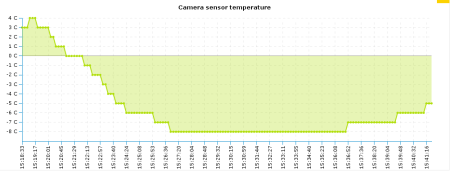
Update: I did the same with a few pictures from the Hollands Hoge Hogte project‘s near-space balloon launch of last August, which also featured a CHDK equipped camera.  Here the camera was in an insulated styrofoam box and it was the middle of summer so the payload was well protected from the cold.  It reached just below 100000 feet with minium temperature of 8C inside the box.  The graph is again suffering from only partial data, the few data points on the far right are from pictures taken by the camera as the box was floating in one of the Dutch bays just before recovery by a boat.

For some background, most programmable chips these days have a sensor of own temperature, an average cell phone probably has a number of them even if the phone doesn’t use or expose the measurement results in any way.  My old Palm PDA for example had an unused temperature sensor in the touchscreen controller that could be read when Linux was hacked onto the device.  The Canon cameras also measure their temperature and save the result in the images with 1 centigrade accuracy, at least when the CHDK open-source firmware is installed on them, (which seems very popular in many do-it-yourself projects like aerial photography and weather balloon launches).
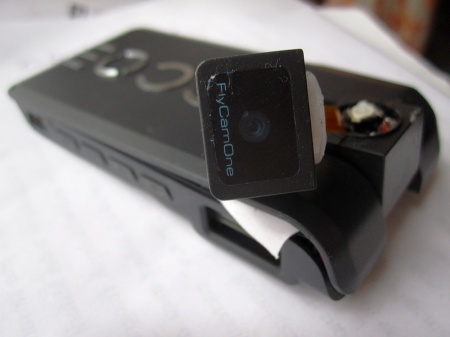
FCOIII looking sad

January 7, 2011

This is my FPV camera after a 200m dive from the kite when the rig failed yesterday.
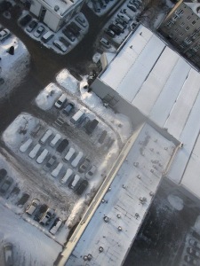
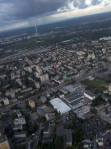
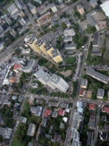
It fell on the roof of a Ferrari car-service (seen below from a photo camera which made it safely to the ground) and it kept recording/transmitting for another 30 minutes despite the twisted head joint and being covered in snow.

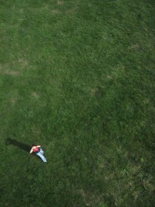
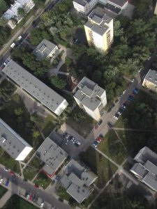
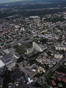
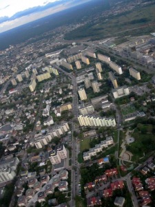
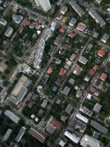
By the way I have selected some of the occasional interesting aerial shots taken by the camera as it’s making the vertical imagery or from a paraglider or airplane window or on other occasions, and collected in a picasa album here, though I now have a two months backlog of winter kite pics.

In other news last week groupon.com had an offer for sight-seeing flights over Warsaw in a two-seater ultra-light airplane for just about EUR20. I bought three coupons :)  They let you decide the route and altitude and buy additional kilometres for 50cent/km and I hope that will let me complete most of the free (as in freedom) orthoimagery map for my city, till now made with the kite or rc helicopter.

MediaLab Chrzelice and KAP

September 6, 2010

Three weeks ago I took part in the MediaLab Chrzelice aka. Culture 2.0 Camp, and didn’t have time to mention it here yet.  I wrote about it in some more detail at the OSM diaries here & here, but let me just say that it was lots of fun, and I’m also really satisfied with how the OpenStreetMapping part of the workshop turned out.  I was never really good at convincing people to do things, but at the workshop I had introduced the project to people who had never heard of OSM and they were immediately very eager to actually go out and start collecting data and then putting it onto the map as quickly as possible (specially since the village where this was held was a very blank spot), which was very satisfying to see.  The GPSes hadn’t arrived, and we didn’t manage to produce good aerial imagery, but trying to launch the balloon and then flying the kite was fun anyway (possibly educative? when something fails is it more educative or less educative?). Two people who had come from Warsaw like me signed up for re-trying the balloon launch some time in the coming weeks, using some new ideas we had. Also one of the concurrent workshops was the Arduido workshop led by Daniel Soltis of Tinker.it! London and I got an arduino kit as a gift. I had some ideas of things I’d like to do with an arduino board, the only problem is I’m truly clueless about low-level electronics (I’m definitely a software person), I can’t even solder properly, so whatever I do with it, I’ll need help making any use of it.

My friend and me had some more attempts at Kite Aerial Photography here in Warsaw after I was back and actually are starting to get some nice pictures although I still need to build a better rig for the camera and get more line (currently have 600 metres and that let us lift the camera to 450-500 metres above the ground).  The current rig was the “plastic bottle”-type (aka. pendulum type) just without the bottle, using just string and duct tape, and attached just about 3m below the kite.  The advantage is that you get pictures taken in all directions.  With a picavet-type rig they will be looking straight down but the swinging is greatly reduced, specially if the rig is attached some 20 metres below, and so you can get much better ground resolution even on not-as-sunny days, because the exposition times can be longer and ISO lower.  So possibly I’ll be attaching multiple cameras instead of one to cover more directions, or building/ordering one of the fancy RC rigs (but more likely just attaching three or four cameras if I can get them from somewhere).  I figured out how to do “interval photography” with a WebOS phone like the Palm Pre (without installing any App Store apps like the Time Lapse Maker for EUR1.99) and I’ll post my app here later — turns out making webOS apps is really simple, even if you’ve never made any you can make a time-lapse app in about 1h without using any SDK or documentation, when on a bus trip for example.

Also my early impression with the latest Canon cameras is that they are terribly bad and there can seriously be no other reason to buy one other than CHDK suport (although the really new ones are not supported anymore because the firmware blobs encryption has changed — particularly what the CHDK developers call the dancing bits sequence).  If you’re looking for a nice pocket camera with high ccd resolution, get a Casio for example (seems to be just starting in the pocket camera market), although not usable for KAP.  I was never very up-to-date with things like hardware specs and prices and benchmarks but now that I had to decide on a camera, I’m taking the opportunity to sound like I have a clue :)

For the next couple of weeks I will be super busy with a university project (I even took a week of vacations at work) and will resume my world dominationkite flying plans afterwards.  I’m also seriously considering RC drones, some of the cheaper ready-to-fly models are slightly cheaper than the bigger kites.  The problem with the kites is that to make a good photo-map suitable for mapping, covering the area size of Warsaw, I’d need to fly it in about 80 places in the city and while it’s fun, it’s also tiring, possibly risky (if you haven’t registered with air traffic control a week ahead) and very weather-dependent.  With drones these are all things yet to figure out as people are just starting to experiment as far as I see on the web.